


 PALM SPRINGS PALM SPRINGS
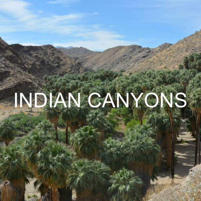
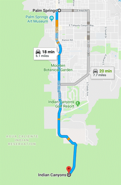
1. Indian Canyons (At least 2 different hiking to do)
- Indian Canyons : (take South Palm Canyon Drive till the toll entrance of the park) Adult: $9; Child 6-12: $5/; 65+: $7
OPENING HOURS
September 1 -July 4: 8 am-5 pm open daily
July 5 - August 31: 8 am-5 pm open Fridays-Saturdays-Sundays
https://www.indian-canyons.com/indian_canyons
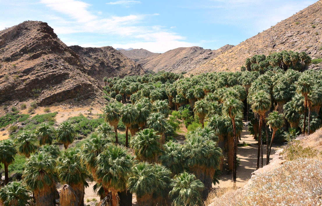
DO ANDREAS CANYON & PALM CANYON
Andreas Canyon is an amazing hiking trail (1 mile loop - about 40 minutes) starting from the parking lot, going up following a narrow passage with stream on your left and palm trees, and abrupt rock formations on your right, then going down on the other side of the trail, with panoramic views of the Canyons back to the parking lot.

After the hike, go back in your car and go to the other hiking place "Palm Canyon."
From the parking lot, already you can admire a spectacular and panoramic view of the oasis down below. Walk down the stairs and enjoy either the oasis down below or hiking the area.

 2. L'Ange sur la Montagne
- The Angel and the Christ on the San Jacinto Mountain

Directions :
From downtown Palm Springs, take Indian Canyon Drive and just before the freeway I-10, turn left in a small road surrounded by sand to the train station. From the parking lot, enjoy the views, and especially the "Angel and Christ" edged onto the rocks of the San Jacinto Mountain. Best to view and for photos are mornings from sunrise till the sun is on the mountain which is usually around 11 am. After that, it is more difficult to see.

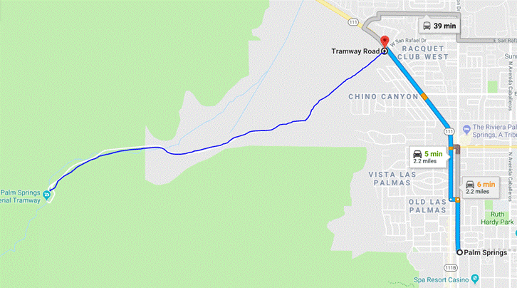
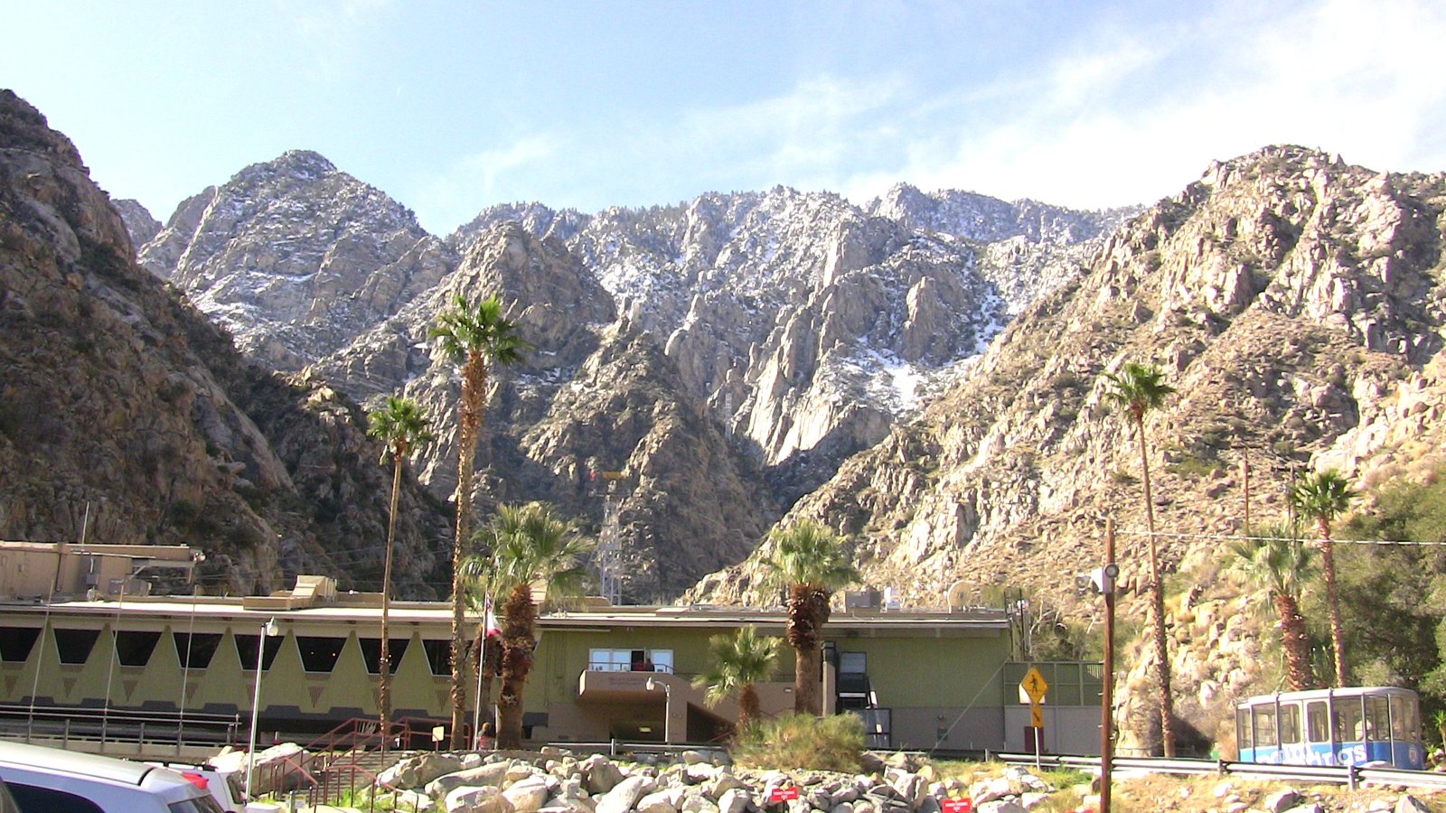
 3. Palm Springs Tramway
- The tramway brings you from the tramway station to the top of the mountain (8,516 feet) in about 12 minutes.
In winter, you will find snow (be prepared) while you can be in shorts in Palm Springs. Yep, this is Palm Springs !
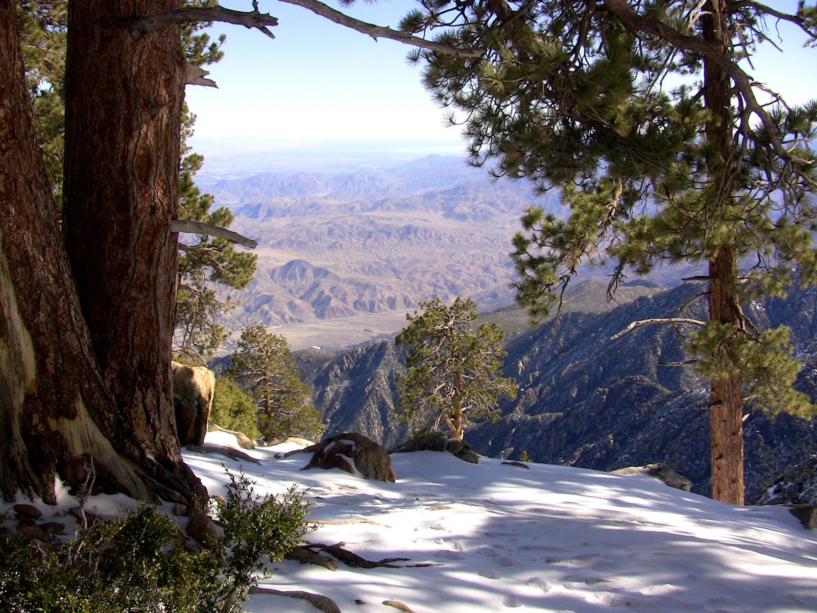
At the tramway, there are 2 restaurants, a gift shop, and a long deck where you can admire the panoramic views of the desert below.
(See their Webcam looking north: https://pstramway.com/about-us/tram-cam/)
or enjoy 50 miles of hiking trails.
See the Webcam where the trails start: https://pstramway.com/long-valley-cam/)
Cost: Adults $26.95; Children $16.95 (ages 3-10); 65+ $24.95.
https://pstramway.com/
TO DO IF YOU WISH TO HIKE FOR AN HOUR OR SO
Desert View Trail (1.2 mile round trip). You will be able to see a magnificent view, and in clear crisp weather, you can even see the Salton Sea (68 miles from Palm Springs)
Directions :
From Downtown Palm Springs, takez Palm Canyon Drive going North, then turn left on Tramway Road, drive up the road for about 3.7 miles to the parking lot.

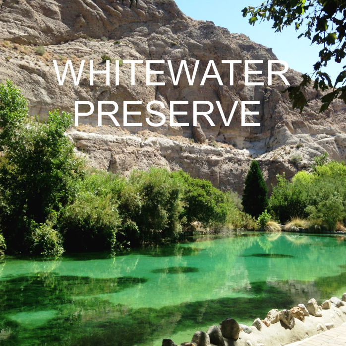
 4. Whitewater Preserve

Directions :
From Downtown Palm Springs, take Indian Canyon Drive to the freeway I-10. Take the freeway going West. Take the 2nd exit on your right "Tipton Road" right after Whitewater Rock & Supply. Turn right on Tipton Rd going towards Whitewater Rock & Supply then turn left onto Whitewater Canyon Road and continue for about 5 miles till you arrive to Whitewater Preserve.
http://www.wildlandsconservancy.org/preserve_whitewater.html
 THOUSAND PALMS
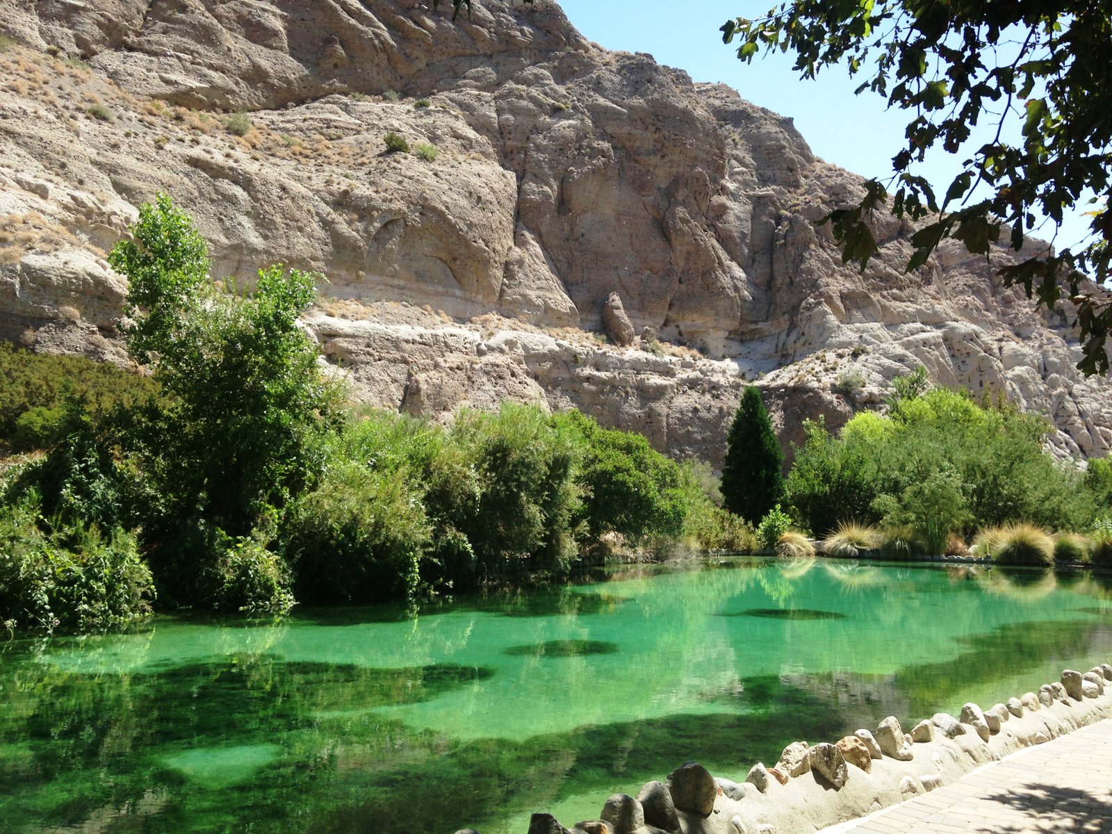
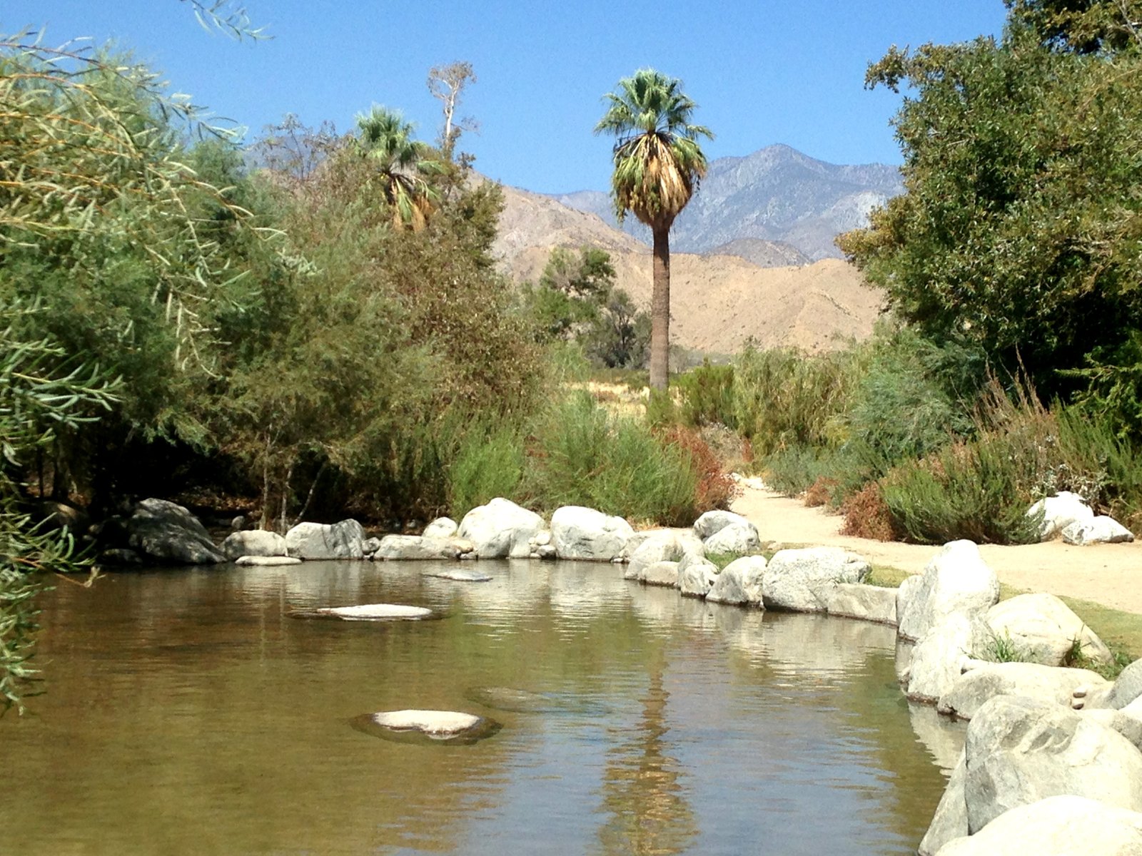
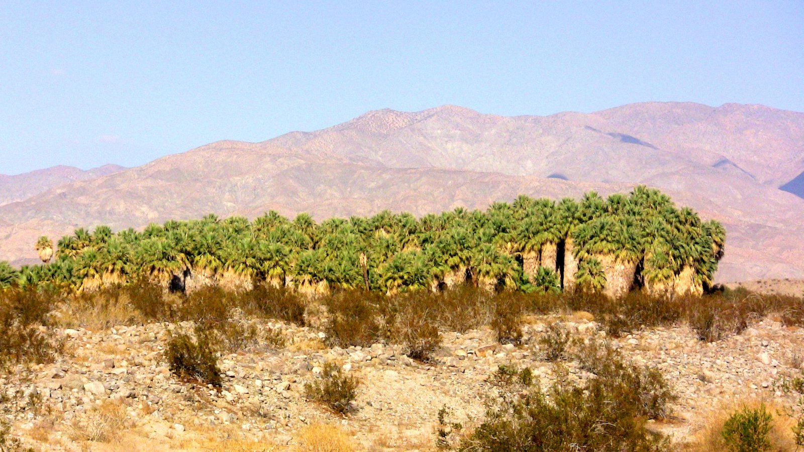
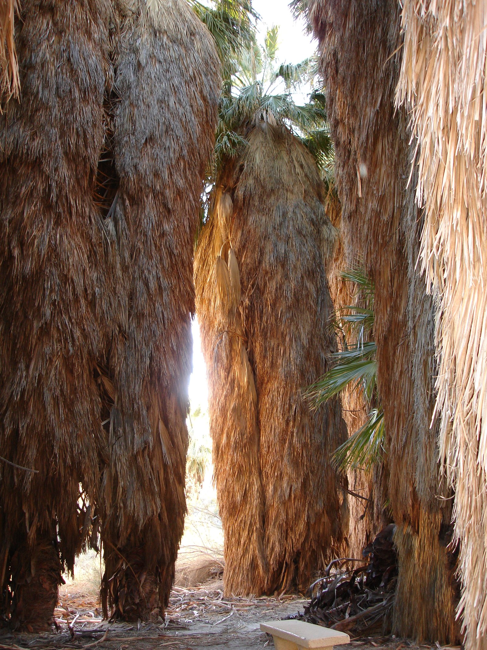
5. Coachella Valley Preserve
(2 oases + walk along the famous San Andreas fault
This place is simply magical and one of my favorites!
Coachella Valley Preserve has several hiking trails through oases, but my favorite is the one you take from the Visitor Center parking lot through two different oases, formed thanks to the San Andreas faultline, brining water up to the surface and at the same time, leaving a whitish layer of salt. The 1 mile hiking of the 2 oasis can be done in about 2 hours. It starts with one oasis, then you walk in the desert (be sure to have enough water, sun screen, and sunglasses) till you arrive to the second oasis with a pond surrounded by palm trees, and a place I named The Cathedral of Palm Trees. There, you can meditate, pray, or talk to these trees. If you think I am crazy, fine. If you are open minded, try it and who knows, you may experience a 'miracle.'

Directions :
From Downtown Palm Springs, take Ramon Road and go straight toward east for about 14 miles. Ramon Rd passes over the freeway and keep going straight.
Turn left onto Thousand Palms Canyon Road and park your car at the Coachella Valley Preserve.
The access is free but a donation is highly recommended, which helps them maintain the trails.


JOSHUA TREE
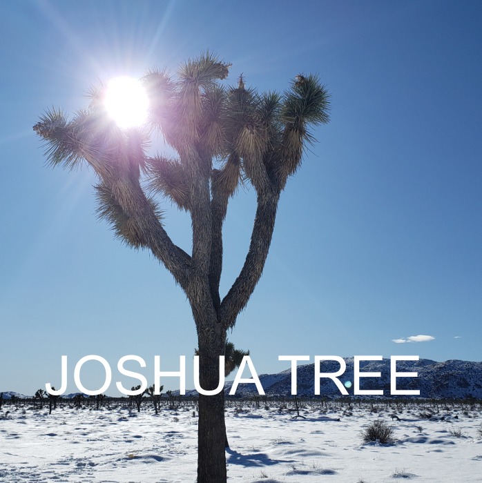
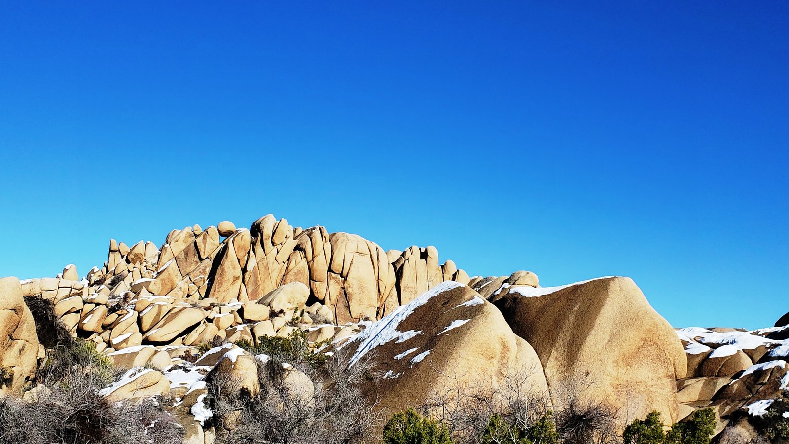
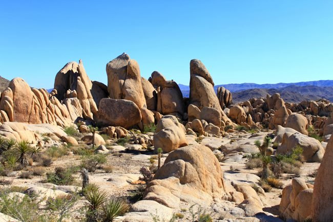
6. Joshua Tree National Park
Joshua Tree National Park is so famous worldwide I do not need to talk much about it.
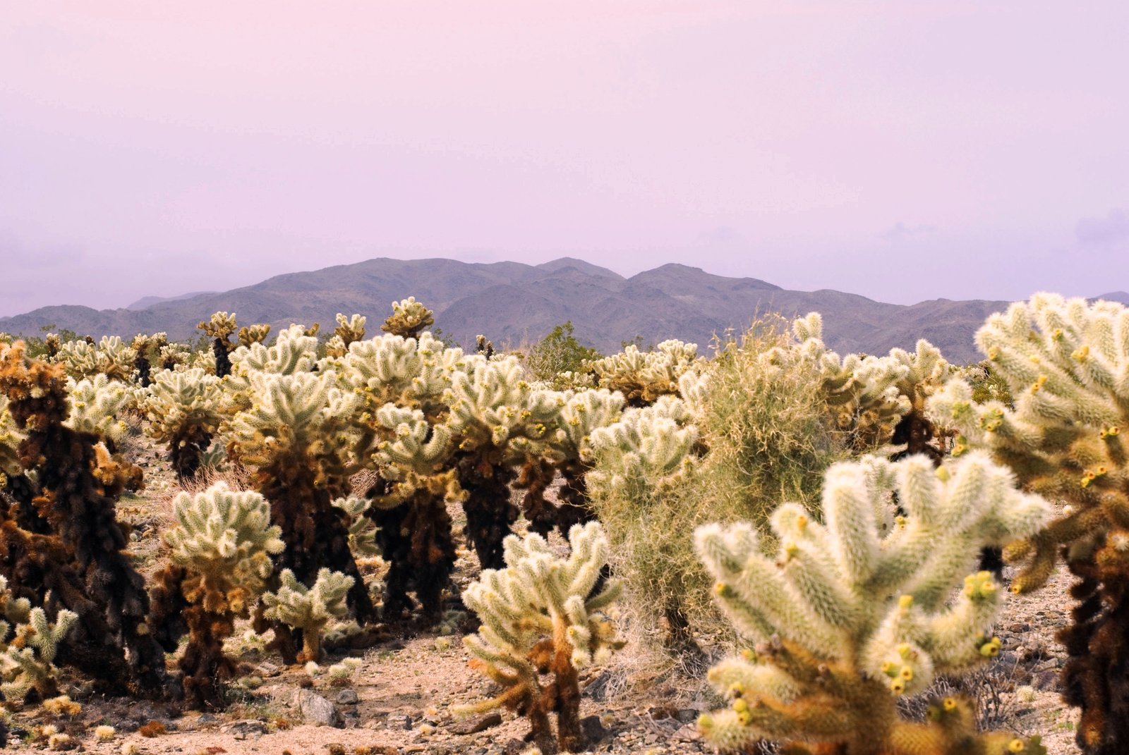
The map below shows the loop you can do entering the park from the north entrance, and leaving from the south entrance back to the freeway. This being said, passed the "orange x" I did on the map, which is the location of the Cholla Cactus Garden, there is not much to see after that. So you could also turn around and drive through the park and leave through the north entrance. As you wish.
NOTE: Be VERY CAREFUL when you visit the Cholla Cactus Garden. It will be on your right side. These cacti look like soft teddy bears you wanna cuddle or touch. PLEASE DO NOT!!!! If you touch them they throw spines that can even cross bags, leather shoes and once they enter your skin they break into thousands of pieces. So PLEASE STAY ON THE TRAIL AND DO NOT ATTEMPT TO TOUCH THEM.
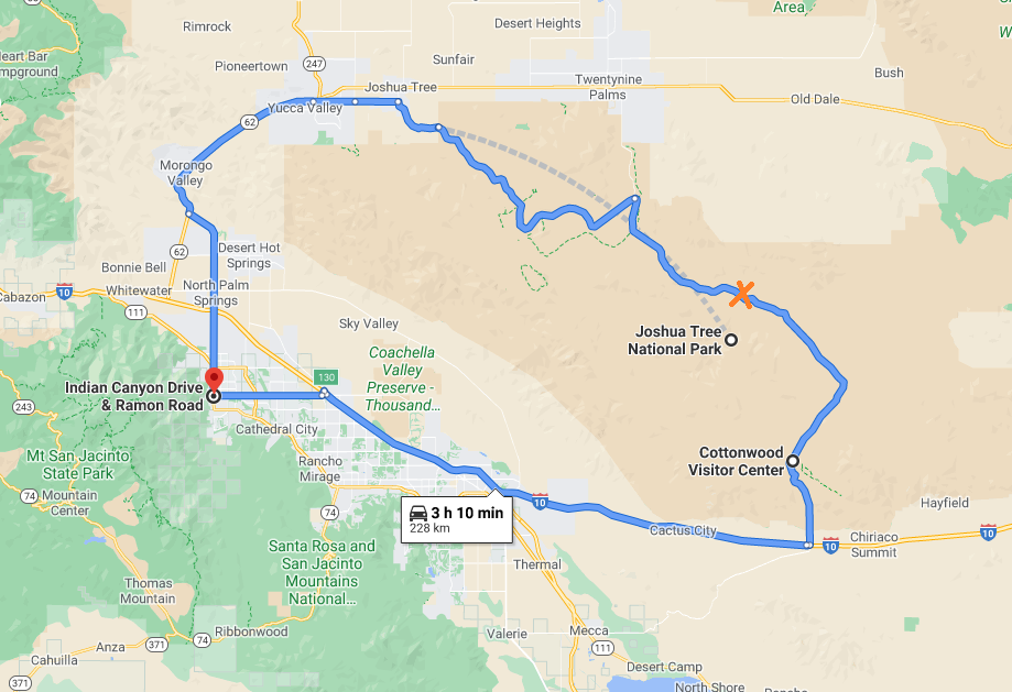
Directions :
From Downtown Palm Springs, take Indian Canyon Drive going nord. Take the freeway I-10 toward West, then take the Highway 62 towards Morongo Valley/Yucca Valley/Joshua Tree/29 Palms.
In Joshua Tree, make a right turn onto Park Blvd. the entrance fee is $30 per vehicle, which gives you the access to the park for 7 consecutive days.

MECCA
7. Painted Canyons
Mecca Hills Wilderness offers a unique experience. It is the only place around Palm Springs to see Painted Canyons. After that you need to go to Death Valley to see the colored hills and mountains.

Directions :
take the freeway I-10 towards Phoenix (East), and exit at Highway 86 Expressway. Continue on Hwy 86 and exit/make a left at 66th Ave. Go straight and make a left onto the dirt road "Painted Canyons Rd" for several miles. Once you are finished exploring the Painted Canyons and you are back on the road, turn left onto Box Canyon till you reach the freeway I-10. Then you can turn left towards Palm Springs.
https://www.blm.gov/visit/mecca-hills-wilderness

SAND DUNES
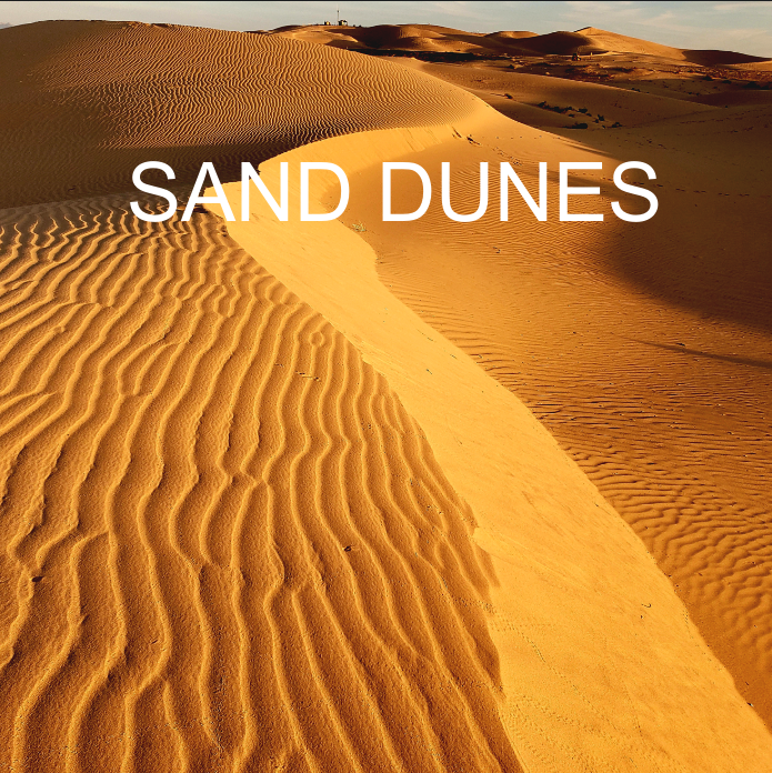
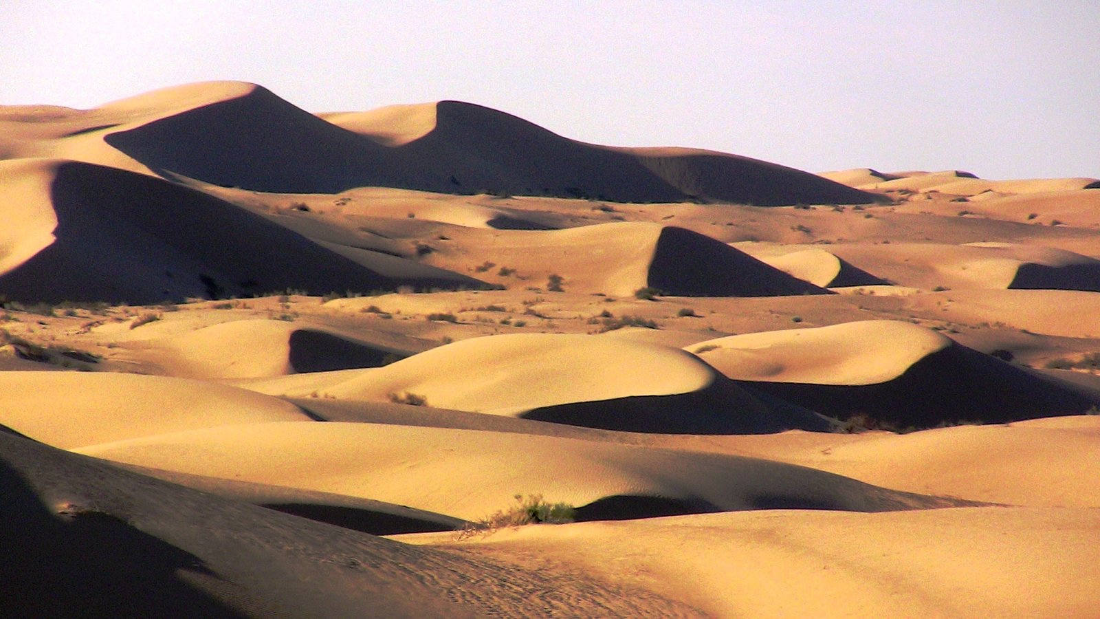
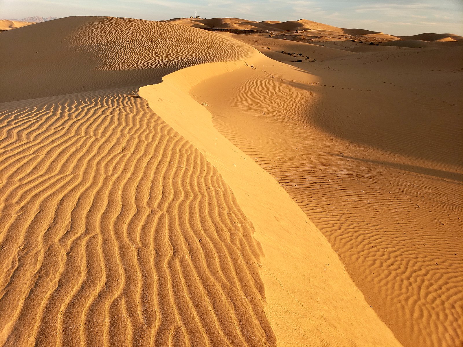
 8. Algodones Sand Dunes
This is One of my VERY FAVORITES!
For this trip, remember to have an ID, or your passport with you, as you will have to pass through the United States Border Patrol interior checkpoint.
the road passes through sand dunes one each side. IT IS MAGNIFICENT and the closest you can get from the Sahara Desert!
It takes about 2h30 to get there. In the middle of the dunes, there is a small road "Osborne Park Rd" going to a view point and also the parking lot.
On the right side of the road, this is Glamis, sand dunes for squad enthusiasts. and on the left side of the road, this is reserved for hikers. Park at the parking lot, walk down the road, cross the road with care (trucks and cars usually drive fast), then enjoy a wonderful time walking in the sand dunes. It's MAGICAL. Believe me!
NOTE : Be well prepared with enough drinking water, sun screen and sunglasses. It can get VERY VERY HOT! I suggest to arrive about 1 to 2 hours max from sunset. It will be less hot and sunsets are usually a dream to take photos.
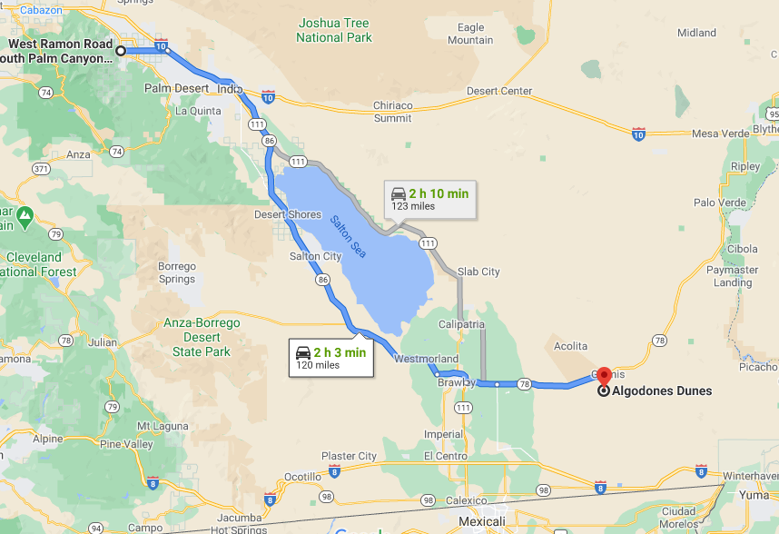
Directions :
(GPS is best).
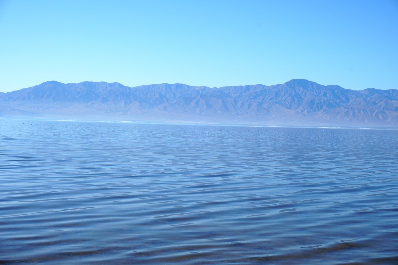
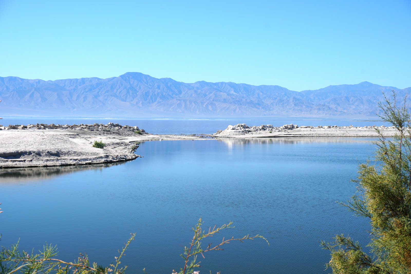
Take I-10 going East. Exit at Highway 86 Expressway/State Route 86. When you see the SALTON SEA on your left, and near the town of Desert Shores, if you wish to do a small detour, I suggest you exit State Route 86 at Monterey Continue on Monterey Ave. then turn left on "Thomas Ave" then right onto Capri Rd. It is an opportunity to see the Salton Sea and take some photos. Be aware than according to seasons, the lake can smell pretty bad.
Come back to Highway 86, and turn left onto it. Stay on Highway 86, which merges onto 78 when you arrive to the tiny village of Westmorland. When you are getting close to Brawley, you can either enter the town or take the "Brawley/El Centro/865 Expy" to 78. Continue on 78. After Brawley, you will have to make a LEFT turn onto 78 (it is tricky -- if you do not turn left, you will then continue on route 115.) Continue on 78. You will see Glamis on your right. Eventually the road passes through sand dunes one each side. IT'S MAGICAL! Take the tiny road on your right Osborne Park Rd. Park your car, walk down the road and enjoy the dunes on the other side, reserved to hikers.
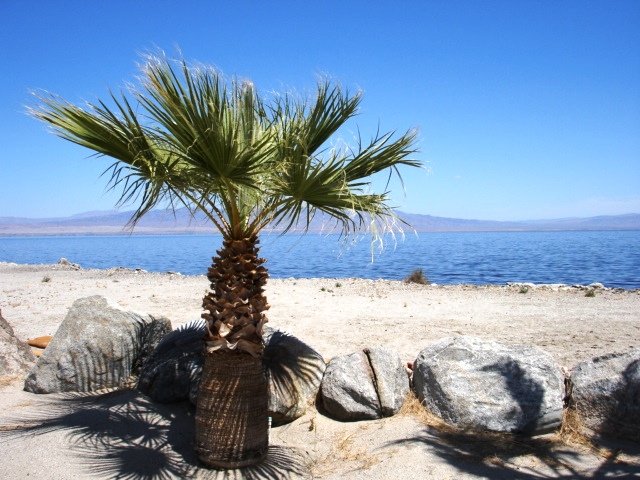
Si vous faites le petit detour par Desert Shores - Salton Sea.

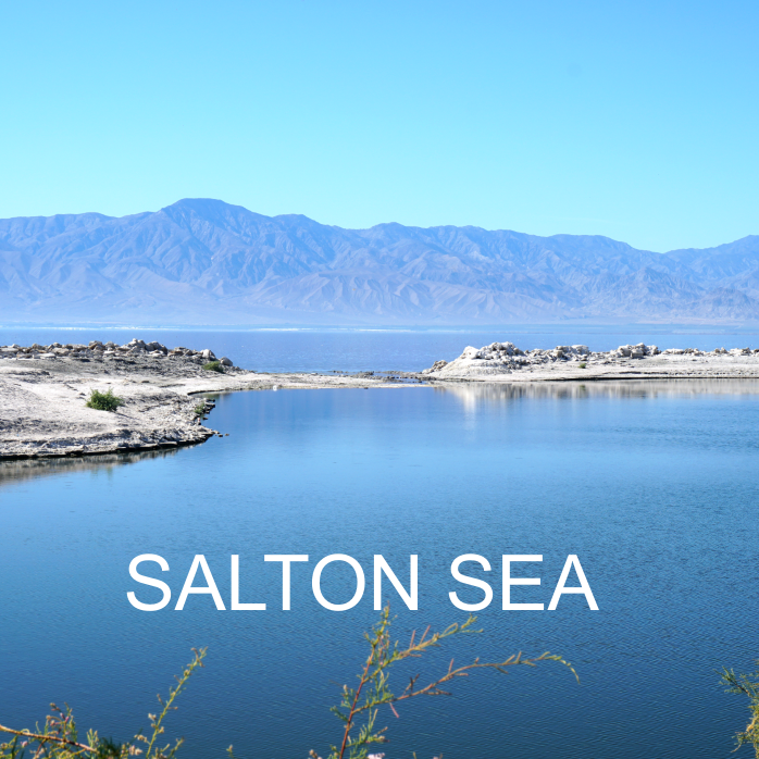
SALTON SEA
9. Salton Sea
You can either drive around the lake as a loop, or only see the most interesting part of the lake by stopping at North Shore Salton Sea Visitor Center then to the Sonny Bono Salton Sea National Wildlife Refuge Visitor Center.
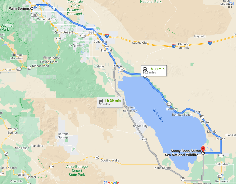
Directions :
Take the freeway I-10 going east. Take Highway 86 Expressway/State Route 86. At Mecca, turn left on 66th Ave then right onto Highway 111. At North Shore, take State Park Rd and go to the Visitor Center. You can also walk around the lake. After your visit, go back onto Highway 111 going south. You can opt a small detour by going to Bombay Beach, a once vacation-dream-place on the lake in the 50's. Now it looks like the time has stopped. Then go back onto the 111 and your next stop will be the Sony Bono Salton Sea National Wildlife Refuge.
To get there, after Niland, continue on 111, and make a right turn onto W Sinclair Rd and go straight till you reach the parking lot of the refuge.

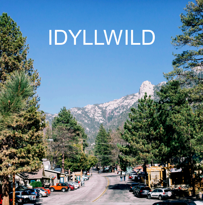
IDYLLWILD
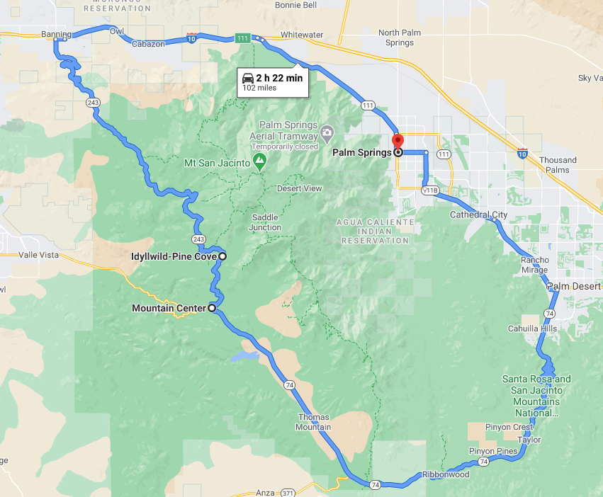
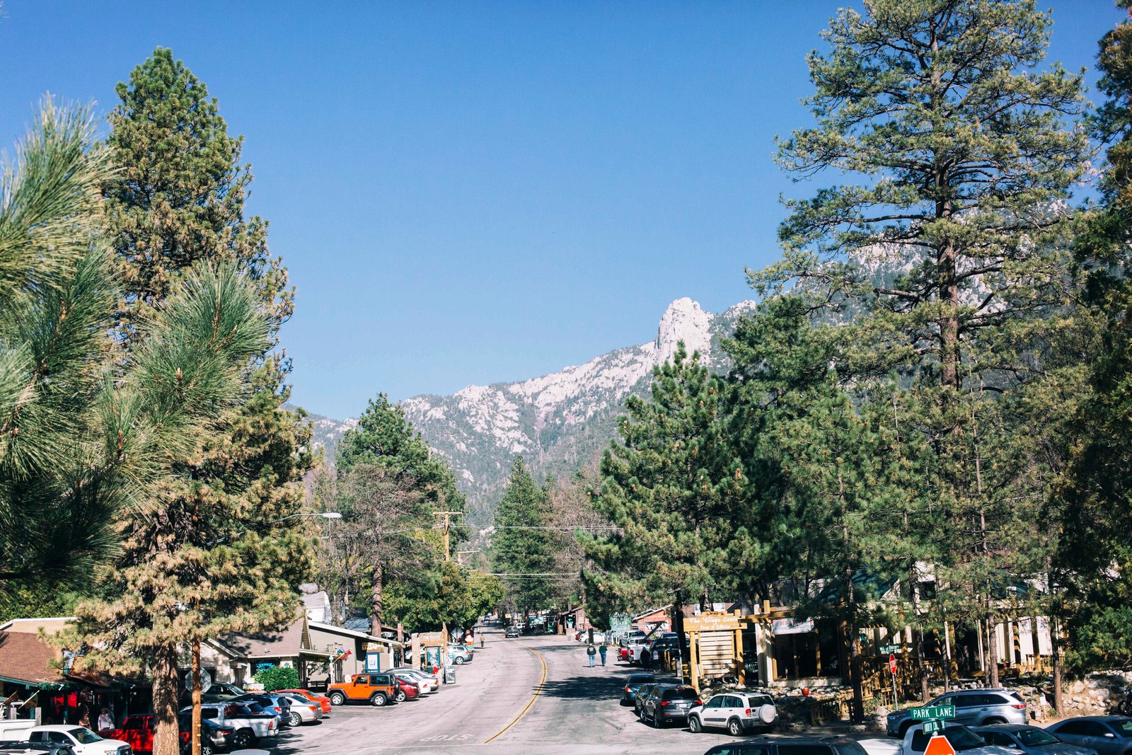
10. Idyllwild
This is about a 100 mile drive (loop starting in Palm Desert back to Palm Springs from the other side of the San Jacinto mountain.)
VIEW POINT : From Palm Desert, take the steep and serpentine Highway 74 with stunning views on the rocks. Make a stop at VIEW POINT then continue the road to Idyllwild, a village that can be snowy in winter, . Drive down through the serpentine road 243 to the freeway and back to Palm Springs.
Directions :
From Downtown Palm Springs, take Palm Canyon Drive, which merges onto South Palm Canyon Dr., then East Palm Canyon Dr., then Highway 111. Drive thru Cathedral City, Rancho Mirage, and Palm Desert. At the intersection Monterey Ave/Highway 74, turn right onto Highway 74. Make a first stop at VIEW POINT, on your left. Continue on Highway 74 going through Mountain Center, Lake Hemet then make a right onto 243 direction of Idyllwild. After your visit, drive down the serpentine road 243 towards the freeway then back to Palm Springs.
|
